It looks to be another cold, clear day here on the mesa top. It’s day three of my adventure at
Hovenweep National Monument. So far I have been taken to all but one of the sites here in the park (the main area where the Visitor Center, Campground, and staff housing are located and four “outliers”). I have learned how to check the campground to see if any campers have used the area and how to collect fees from the lock box there. I have also learned the routine for cleaning the campground comfort stations. The campground at Hovenweep, by the way, is a great little spot. It's quiet and peaceful with nice views of the mesa top and of Little Ruin Canyon. There is also a sweet little amphitheater where campfire talks and gatherings take place during the busier times.
 |
| Hovenweep Campground |
 |
| Entrance to Hovenweep Amphitheater |
 |
| Hovenweep Amphitheater |
In addition to my orientation to the campground routine and visits to the cultural sites in the park I have also learned how to pick up the mail from the postal service drop box at the intersection of two county roads, have begun to learn the routine of opening and closing the Visitor Center (not to mention the unruly safe), done a good bit of reading of park-produced and other literature to gain an understanding of the place, and even had the chance to welcome and orient a couple of visitors. I work another “closing” shift today so will spend the morning out in the park and will attend to the Visitor Center desk this afternoon and have another go at the close-out procedures. So far, so good.
 |
| Mailbox on the Mesa |
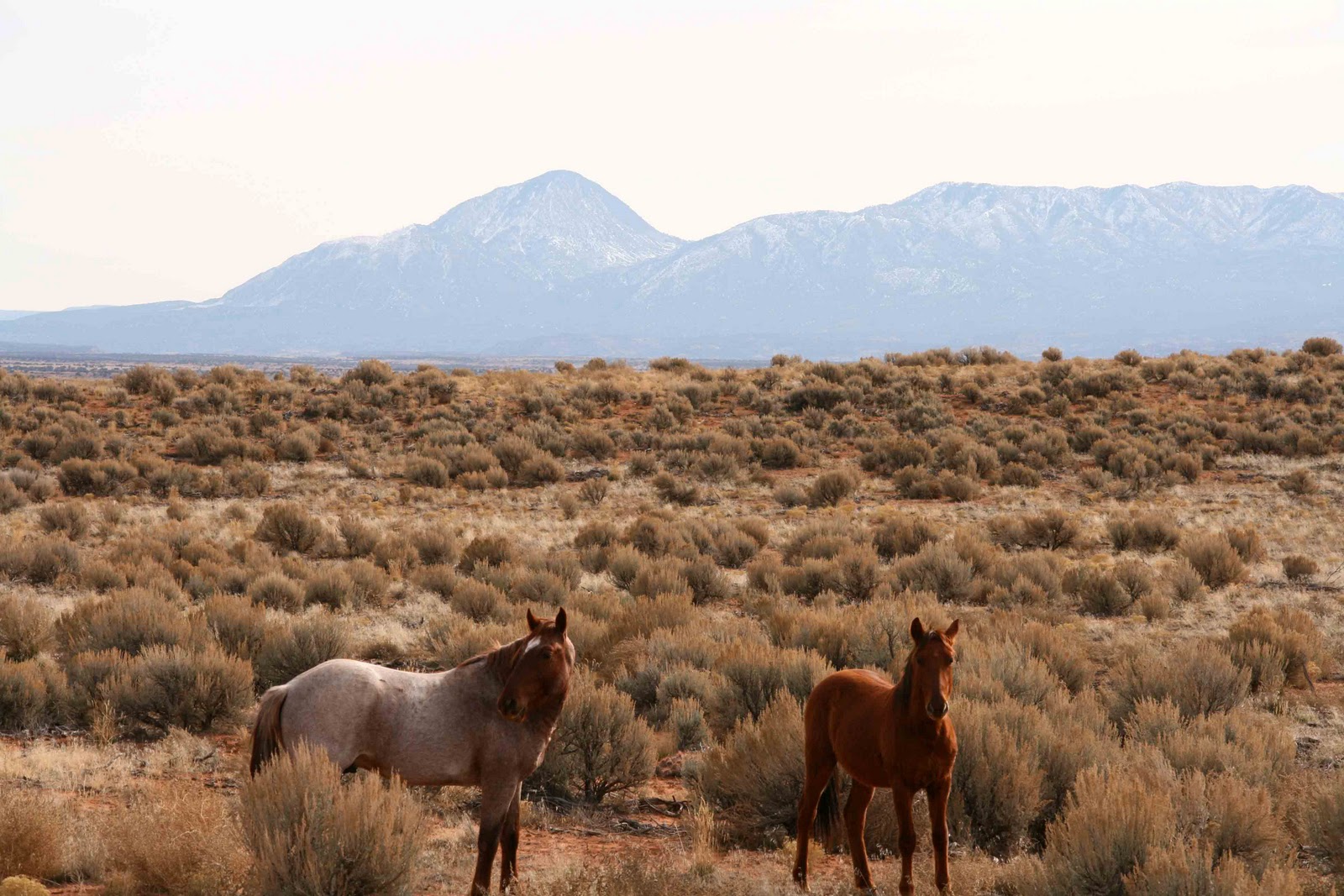
This all speaks to routine but not the place. I don’t know if I have the words yet for the place itself. Awesome, grand, spectacular, sweet, and “really out there” come immediately to mind. This place feels very remote. The park is only forty-two miles from the town of Cortez, CO but being on the mesa top there is little immediate evidence of other people around. There are occasional oil tanks, windmills used to pump water for free-ranging cattle, horses, and sheep on the surrounding Navajo Nation and Bureau of Land Management (BLM) land. A few ranch homes dotting the expansive landscape. Nonetheless, the openness of the land and the harshness of the environment give a feeling of being very isolated. Visitation is low, we had ten visitors yesterday and five on Monday in the snow, so a sense of quiet rules as well, adding to the perceived isolation.
 |
| Free-Range Cow |
 |
| Free-Range Horses |
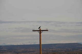 |
| Free-Range Raven |
I find myself particularly drawn to the plants here. For me, they provide a much –needed anchor of knowledge as well as a “way in” to understanding this place. Terry Tempest Williams, one of my literary sheroes, wrote a wonderful piece about her experience as a naturalist from the Great Basin traveling to the very unfamiliar Serengeti Plains of Africa. In the essay, “In A Country of Grasses” she states:
“For a naturalist, traveling into unfamiliar territory is like turning a kaleidoscope ninety degrees. Suddenly, the colors and pieces of glass find a fresh arrangement. The light shifts, and you enter a new landscape in search of the order you know to be there.”
In that kaleidoscopic fashion, the plants here in the high desert, the great sage plain, imply the possibility that I will come to know and understand this landscape. The plants, for me, also are a bridge from the familiarity of home to the unknown here. On first assumption, one might call Hovenweep a cultural site (if one subscribes to that long-standing split between culture and nature, consciously or not) because it is characterized by ancestral Pueblo structures. For me, I first see the arid-land vegetation here, some of it very similar to the plant makeup in parts of
Indiana Dunes National Lakeshore, also, surprisingly to some, an arid environment. And then, upon encountering the ruins and contemplating the lives of the people who built them about eight hundred years ago, it becomes evident to me that the story here is of the land and its inhabitants, and how they co-evolved. The plants hold a story of the harshness of the landscape, the extreme conditions the people faced. The plants also hold a story of ways in which they were used by the human inhabitants and the rest of the more-than-human world here at Hovenweep.
On first glance, any area could have plants similar to those in the Indiana Dunes due to the fact that there are more than
1,100 species of native plants in that small park along the southern shore of Lake Michigan. As a matter of fact, the biodiversity of Indiana Dunes is unmatched by most of the units in the National Park System. In exploring the arid high desert environment of Hovenweep, I find order in comparisons of this place with the foredune and dune complex ecosystems at home. The high desert and the dunes are each ecosystems with very limited access to water and extreme exposure to unobstructed sunlight. The irony of this in the Indiana Dunes is that the dunes are within view of Lake Michigan but similarly parched and dry. With its almost-purely-sand that stands in for soil, the dunes have virtually no water-holding capacity.
 |
| Indiana Dunes from Cowles Bog Beach |
For each of the first high desert plants I have met here at Hovenweep there is a closely related companion species in the dunes. The land here is dominated by big sagebrush (
Artemisia tridentata). In some spots, it seems to be the only plant, in others it is accompanied by Utah juniper
(Juniperus osteosperma) among other species. It seems that once the temperature hits about 50 degrees f. the wonderful smell of the sagebrush is released from the shrub and perfumes the air. My anchoring plant in the dunes is beach wormwood (
Artemesia campestris), a resident of the area just behind the first row of dunes beyond the open beach. It requires very little organic matter to grow and can tolerate extreme heat and dry conditions.
 |
| Big Sagebrush (Artemisia tridentata) |
If I were walking inland from the Lake Michigan shore, I would be likely to find creeping juniper (
Juniperus horizontalis) hugging the sand in a fashion that would allow it to conserve precious moisture. Here at Hovenweep, Utah juniper (
Juniperus osteosperma) is a very common species. It can also hug the ground or boldly stand upright. It seems to be absent in areas that are heavily grazed. I would bet that either the cattle love the juniper and have consumed most of that resource, or that sage is more tolerant.
 |
| Utah Juniper (Juniperus osteosperma) |
The canyons that cut through Cajon Mesa, the areas so critical to the ancestral Puebloan people who inhabited this area some 800 years ago, are home to a few stately Fremont cottonwood trees (
Populus fremontii). The cottonwoods thrive in the canyons because that is where precious water is more available. The ancient ones of Hovenweep knew this, choosing the canyon heads as their preferred locations for their dwellings and other structures. In the dunes, eastern cottonwood (
Populus deltoides) is a fordune tree, occasionally able to take hold, at least briefly, on the open beach. The waxy leaves protect the plant from the devastating evaporation of moisture and the flat leaf stems, being able to turn in even the lightest wind, allow this tree to grow and thrive under extreme windy conditions so common on the Lake Michigan shore. The wind in the canyons of Hovenweep can also be extreme. Cottonwoods are very well adapted for life here.
 |
| Fremont Cottonwood (Populus fremontii) |
I was thrilled to see some residual fall colors, dusty red and brown leaves caught in a pocket of sand and twigs on the trail.
 |
| Residual Fall Colors |
These were the leaves of threeleaf sumac (
Rhus trilobata), also called skunkbush because of the not-so-fragrant leaves, and lemonade bush or lemonberry because of the sour taste of the fruit. I was excited to learn that Pueblo people today make a soup or stew from the ground berries with added cornmeal. Indiana Dunes is home to five species of sumacs (staghorn, smooth, winged, poison, and fragrant). Our fragrant sumac (R
hus aromatica) is the sand dune species. The others are found in somewhat more inland areas of the park. It is the closest companion to the threeleaf sumac of Hovenweep. I would also question the choice of the term "fragrant" to describe it. Odiferous may be a more appropriate term. Or skunkbush. I have never found it a pleasant smell, though a distinct one. Nonetheless, like the threeleaf sumac, fragrant sumac is an arid-land species and one of the plants here that provides me with a sense of familiarity and home.
 |
| Threeleaf Sumac (Rhus trilobata) |
As one would expect in a desert environment, there is cactus here at Hovenweep. Most prevalent here is the common pricklypear (Opuntia erinaceae). I have also encountered the claret cup cactus (Echinocereus triglochidatus). Prickly pear cactus grows commonly in the Indiana Dunes. The pricklypears in both locations have similar qualities, habitat requirements, and unique adaptations. Our local species (Opuntia humifusa) can be found in the very dry areas behind the foredune, often in association with boreal remnant species like jack pine (Pinus banksiana) and arctic bearberry (Arctostaphylos uviursi). It is this diversity of southern and northern species that makes Indiana Dunes such a unique and valuable ecological oasis. The species of cactus at Hovenweep link me to home.
 |
| Common Pricklypear (Opuntia erinaceae) |
It is no surprise that I gravitated toward plants when getting to know a new place. As a budding childhood naturalist, plants were my first real subject of study. I inherited my love of plants, particularly woodland spring wildflowers from my mother. She nurtured and allowed for that love as well. She tolerated and eventually embraced my fascination with wild edible plants. I can not see an elderberry bush blooming in the spring without thinking of how much she enjoyed making elderberry blossom fritters using a recipe from Euell Gibbons' Stalking the Wild Asparagus, a treat I had first introduced her to. Knowing the Indiana Dunes as well as I do, and having a strong, lifelong affinity for plants, it is no surprise that I would find solace and familiarity in them here at Hovenweep. They are the seemingly random pieces of glass in the kaleidoscope and help me to find the order I seek. For this I am grateful and comforted. Home, for me, is also a homing ground, the land to which all is compared. Here in this new and seemingly unfamiliar place, plants are a wonderful way in. I greatly look forward to the things this place can teach me.