I recently hiked the one trail I had yet to see. It is a very short trail that leaves from the Zion Canyon Visitor Center. There was, I believe, a reason it took me three months to finally hike the Archeology Trail.
 |
| Archeology Trail Trailhead Sign |
I had been given no encouragement to venture onto the Archeology Trail. Instead, I was actively discouraged from using the trail by a number of my co-workers. I was told that it was not very interesting, it was shadeless and hot, it was not scenic, and it was boring. I got the distinct impression that the perceived trouble with Zion’s Archeology Trail for many of the park’s rangers was much the same as Gertrude Stein's trouble with Oakland—a feeling that “there is no there there.” As a case in point, when getting ready to hike the Archeology Trail earlier this week in order to photograph the sights, a co-worker asked where I was headed and upon learning where I was going responded with a simple, “why?” Others had recommended against this trail and I found myself occasionally doing the same while on duty at the Visitor Center. I told visitors it was not a very interesting trail, hoping I would not have to admit that I had not even set foot on it.
I have always had misgivings about blindly editorializing for park visitors, imposing our own and often-unfounded value statements on them. I have also found it difficult when fellow workers discount visitors and the places they express interest in, acting as if parks were set aside solely for those of us who work in them. When I worked in Ross Lake National Recreation Area/North Cascades National Park Complex many years ago, some of my co-workers informed me that the park was really a “ranger playground” and that visitors were often an inconvenience at best. That notion never sat well with me and I have since been a vocal defender of the range of experiences park visitors have, whether it is one framed by a car window or one had while exploring true wilderness. Each of these, and all experiences in between, are valid, can be deeply meaningful, and are sometimes transformative.
I am currently reading a lovely book called Landscapes on Glass: Lantern Slides for the Rainbow Bridge-Monument Valley Expedition which documents a photographic expedition in the American southwest, investigating potential additions to the National Park System. The 1930s expedition was led by Ansel Hall, the first Chief Naturalist of the National Park Service (NPS). In the short introductory biography of Hall, it was noted that the following preface was included on the application form filed by prospective NPS employees. “The duties of Ranger Naturalist require a full day’s work each day—work entailing continual contact with the public. If you are not absolutely certain that you can maintain an attitude of enthusiasm and courtesy, please do not apply for work of this sort.” I am a strong proponent of both enthusiasm and courtesy. I also deeply believe that a positive attitude and an expectation of plenty will bring each of us far more joy than the alternative. Changing our attitude can change our organizational culture in a way that will allow us to provide a far better experience for our visitors. If I were hiring Ranger Naturalists in Hall's day (or today, for that matter), I would also add that the applicant's cup needs to be half full, if not more.
I have hiked the Archeology Trail three times, now, in a week. With each short ascent I have discovered new wonders. It is out of respect for this place called Zion and the experience of our visitors, and in honor of Ansel Hall’s attitude of enthusiasm and courtesy that I offer to you, my readers and colleagues:
"Twelve Great Things About the Archeology Trail at Zion National Park"
Great Thing #1: The Archeology Trail increases the use of one’s imagination. The initial purpose behind the Archeology Trail was to provide access to an excavated archeological site. Though little evidence of Ancestral Puebloan life approximately 1,000 years ago exists, one can hike the trail with an open mind, imagining what life may have been like for the earlier residents of the area. Archeologists excavating the site found two storage rooms, three storage cists, two fire hearths, stone tools for grinding and other types of food processing, and 11 different styles of prehistoric ceramics. The Zion National Park museum collection contains more than 1,600 artifacts from this site.
Belden Lewis, a twenty-year old enrollee in the Civilian Conservation Corps (CCC) at Zion kept a diary during much of his first year here. He provides a wonderful example of using his imagination and observational skills while visiting an archeological site. On Sunday August 26, 1934, less than a month after his arrival at Zion, he visited the “Boy Scout Granary” along the Floor of the Valley Road by the Great White Throne overlook. Following is his diary entry for that day.
 |
| Storage Shelter Interpretive Panel |
Belden Lewis, a twenty-year old enrollee in the Civilian Conservation Corps (CCC) at Zion kept a diary during much of his first year here. He provides a wonderful example of using his imagination and observational skills while visiting an archeological site. On Sunday August 26, 1934, less than a month after his arrival at Zion, he visited the “Boy Scout Granary” along the Floor of the Valley Road by the Great White Throne overlook. Following is his diary entry for that day.
Sunday August 26—
I went swimming today! Up at lower & upper emerald pools. Oh for fancy! Lower pool not so hot. In fact it’s damn cold. But the environment is enticing & the water fall is cute. Upper pool is the best with the prettiest scenery & the cutest pool. I went on up past Angel’s landing & saw that cliff dwelling. I crawled into it & imagined myself as an ancient man! It is a hut 7 ft. long X 4 ft. wide X 3-1/2 ft. high with a hole 1-1/2 ft. X 2 ft. for a door. The floor is rough natural stone. A good view of Great White Throne can be seen through the door. Well, I got home in plenty time for a good supper, after which I washed some clothes…If I had some mail, this would have been a perfect day.
Like Lewis, people hiking the Archeology Trail can not only make similarly keen observations, they too can imagine themselves as ancient children, women, and men.
Great Thing #2: The Archeology Trail provides an opportunity to understand the challenges an archeologist faces and a true picture of the kind of scene an archeologist is first presented with. Archeologists do not simply happen upon a scene that tells a complete story about past ways of life. By carefully locating, cataloging, and examining artifacts as well as studying the context in which they were found, archeologists focus on the relationship between material objects on one hand and the makers' behavior on the other. As primary goals, archeologists set out to construct a chronology of the past, understand ways of life that no longer exist, and come to an understanding of how and why human culture has changed over time. This work is most often done with no written record as a guide. The site atop the Archeology Trail is the type of blank canvas that archeologists often first encounter. It is clear that they must depend on their scientific methods and skills as well as a bit of imagination to piece together the story from the area examined. Knowing about the challenges faced by archeologists can allow us to become better interpreters of archeology, more accurately and compellingly telling the stories of such sites.
 |
| Outline of Grain Storage Structure |
Great Thing #3: The Archeology Trail gives the visitor a chance to imagine why the site was chosen by the Ancestral Puebloan people for a food processing and storage area. The site atop the Archeology Trail is a logical location to prepare and store food. The small promontory is well above the flood level of the Virgin River. This makes the site ideal for storing of food. There is no threat of food supplies being damaged or lost to the frequent floods experienced just feet below. The small rise also elevates the site above the surrounding area, affording a nice breeze. This could have been helpful in drying food for storage.The 360 degree view also allowed those using the site to see any potential threats to the food supply, be it environmental or otherwise.
Great Thing #4: The Archeology Trail provides visitors with an opportunity to learn about the challenges of preserving cultural resources. The archeological site interpreted atop the Archeology Trail at Zion is a "stabilized" site. This means it has been excavated and then filled in. It leaves little to actually see. This method, however, is the best way to protect the resource from erosion and illegal collection. The site along the Archeology Trail has the lowest level of protection, in which visitors area not only allowed, but welcome to visit and explore, and learn. There are other sites within Zion with greater protection thus limited or no access allowed. In this case, the knowledge of the site sits in reports. It is our challenge to acquire that knowledge so as to relay it to interested visitors. The site also offers a great lesson in resource protection in what is not there as much as in what was found there.
 |
| Rock Rubble in Food Storage Site |
Great Thing #5: The Archeology Trail provides outstanding views both up and down Zion Canyon. Ending on a lovely rise above the canyon floor and a good distance from the east canyon wall, the Archeology Trail offers unobstructed views to the north (up canyon) and south (down canyon). Enough said!
 |
| Looking Up Zion Canyon |
 |
| View to the South |
Great Thing #6: The Archeology Trail looks over the park shuttle bus system garage, allowing visitors a behind-the-scenes look at a seamless operation as well as the interactions between park resources and infrastructure. The “Watchman Site” was an Ancestral Puebloan food storage location threatened by construction of the park shuttle bus facility. A thorough survey of the site was completed prior to the construction of the bus garage and staging area and subsequent implementation of the Zion's shuttle bus system. The proximity of the Archeology Trail to the shuttle bus facility and the fact that the bus garage, parking area, and fuel tank are all visible from the trail illustrates the tension between resource protection and providing facilities and infrastructure for visitor enjoyment. This is the tension at the very heart of NPS activities since, at least, the passage of our Organic Act in 1916. The shuttle bus system in Zion provides for the enjoyment of the park by current and future generations of visitors. The shuttle system itself was designed to increase the quality of the visitor experience while protecting park resources. The survey and excavation of the site atop the Archeology Trail and adjacent cultural areas prior to construction of the bus facility was part of the NPS effort to leave the resources of the park unimpaired. The view of the shuttle bus facility from the Archeology Trail brings the tension front and center. We can not ignore it nor be lulled into thinking that problems are solved magically. The trail helps to illustrate concessions made to protect resources in an unimpaired state while also providing for visitor enjoyment. Nothing hides here. This, I think, is a good thing. There is no wizard behind the curtain to ignore.
 |
| Park Shuttle Bus Facility |
Great Thing #7: The Archeology Trail is a great place to look over the lower section of Zion Canyon and understand the process of canyon widening. The process of canyon widening takes place in Zion, primarily where the Virgin River has carved through the massive cliff-forming Navajo Sandstone into the softer layers of the Kayenta and Moenave formations below. The erosive potential of the river is extreme in the softer lower layers of mudstone, siltstone, and clay. As the river undercut into the Kayenta and Moenave, the Navajo was no longer supported and collapsed, widening the canyon dramatically. This wide canyon can be easily seen from the Archeology Trail.
 |
| Wide Canyon and Watchman Campground |
Great Thing #8: The Archeology Trail provides an outstanding view of the Moenave, Kayenta (including the Springdale Sandstone), Navajo, and Temple Cap geologic formations. From the top of the Archeology Trail, one is afforded an opportunity to see all of the rock layers exposed in the lower section of Zion Canyon, representing about 200 million years of sedimentation. The Archeology Trail itself is entirely within the Moenave formation, a mixture of siltstone and sandstone forming the lower slopes in the area around the Zion Canyon Visitor Center.
 |
| Layered Geologic Formations |
The Archeology Trail itself is entirely within the Moenave formation, a mixture of siltstone and sandstone forming the lower slopes in the area around the Zion Canyon Visitor Center. From the trail, one can see the Springdale Sandstone, the lower, riverbed sediment member of the Kayenta formation. This is the short cliff-forming material that one ascends when walking to the top of the nearby Watchman Trail. The Springdale is also seen well in all directions from the Archeology Trail.
 |
| Watchman Trail Mesa of Springdale Sandstone |
Above the Springdale Sandstone, the remaining slope-forming Kayenta formation is clearly visible. The Kayenta is made up of muddy flood plain deposits. The dramatic high cliffs of Zion so evident from the Archeology Trail are the Navajo Sandstone, the lithified remains of the world's largest erg or sand dune desert. Topping the geologic layer cake is the red or pink Temple Cap formation, laid down in a combination of marine and nearshore sand dune environments. All of these marvelous geologic formations can be seen and well-understood from the Archeology Trail.
Great Thing #9: The Archeology Trail is a good vantage point from which to see the riparian zone in relation to other areas in the canyon. Gazing at the floor of Zion Canyon from the high point on the Archeology Trail, one can clearly see the course of the Virgin River, lined primarily by Fremont cottonwood trees. Cottonwoods will grow only in the riparian corridor or other areas with a ready supply of water. They are easy to distinguish from this vantage point, with their somewhat silvery and shiny appearance in summer, and their leaves that flutter in even the slightest wind. One can see how lush the riparian zone is and can compare it with the drier, more sparsely vegetated uplands visible from the trail’s promontory.
 |
| Riparian Zone and Zion Canyon |
Great Thing #10: The Archeology Trail ends on a small rise above the canyon floor and is often refreshingly breezy. Though only eighty feet above the floor of Zion Canyon, the small terrace atop the Archeology Trail is high enough to frequently offer a nice breeze. While the air on the canyon floor can seem extremely still, the wind at the high point of the trail can be very refreshing. This breeze may have played a role in the selection of the site by the Ancestral Puebloan people. It may have aided in the drying of grain and other foods stored there and kept damaging insects at bay.
 |
| Promontory As Seen From Below |
Great Thing #11: The Archeology Trail is a short walk that offers excellent views of sunrise and sunset. Many, many visitors to Zion want to know the best place to see sunrise and sunset. This can be problematic in that Zion Canyon runs primarily north and south. The enormous sandstone cliffs often mask the comings and goings of the sun. As it turns out, the promontory on the Archeology Trail affords one a lovely view of sunrise and sunset.
 |
| Fading Light on the Watchman |
As the sun begins to drop behind the canyon walls to the west, fading light can be seen on the features on the eastern side of the canyon such as the Watchman. As the sun continues its descent into the western sky unique shadows are cast across Zion Canyon.
Great Thing #12: The AT&T cell phone signal is pretty good from the top of the Archeology Trail. The importance here may be very selfish, but with a strong signal it means that while on the Archeology Trail I could more reliably communicate with you than is possible anywhere else on the canyon floor. I might even be able to send you a picture by text or successfully post to Facebook. I have had a number of visitors approach me asking where they can get an AT&T signal. Now I have a good, and positive answer.
 |
| Canyon Wall Shadow on Bridge Mountain |
Great Thing #12: The AT&T cell phone signal is pretty good from the top of the Archeology Trail. The importance here may be very selfish, but with a strong signal it means that while on the Archeology Trail I could more reliably communicate with you than is possible anywhere else on the canyon floor. I might even be able to send you a picture by text or successfully post to Facebook. I have had a number of visitors approach me asking where they can get an AT&T signal. Now I have a good, and positive answer.
 |
| Your Author's Cell Phone Photo |
Singing the praises of the Archeology Trail at Zion has been a beneficial exercise. On one hand, it is classic bforist behavior, advocating on behalf of the proverbial underdog. More importantly, it has caused me to experience and therefore think of the site in a very different light. I am hopeful that I can draw others into the exercise. I am certain that there are sites in the parks and protected areas where my friends and colleagues work that are, like the Archeology Trail, the perceived ugly step-children of the park. When we take the time to get to know the sites, we understand it very differently and are then able to share it joyfully with our visitors.
I invite you to join in the conversation, sharing your own thoughts about Zion's Archeology Trail, a similar site where you work, and the transformative ways those sites can creep into our consciousness.
Below are Seven More Great Things About the Archeology Trail at Zion National Park and, in some cases, my comments.
Great Thing #13: The Archeology Trail provides visitors an opportunity to route find on a safe, small scale.
--Anonymous Zion National Park Ranger
[Author's note: I think that the Archeology Trail also provides us, as park rangers, with a great opportunity to assist visitors in route finding. The true art is in describing how exactly to find the trailhead. Perhaps I need to commit myself to creating pictures which might help. We have also bandied around the idea of painting animal tracks on the sidewalk and parking area at the Zion Canyon Visitor Center, with a different species directing people to each of the trails that radiate from there. Perhaps bare human footprints or yucca sandals would be the appropriate symbol directing visitors to the Archeology Trail. The trailhead is immediately to the east of the only entrance to the main Zion Canyon Visitor Center parking lot. From the stop sign at the lot entrance, you will need to cross the lane and walk about 50 feet to the right. You will then see the sign marking the beginning of the trail. Alternatively, as you approach the entrance of the Zion Canyon Visitor Center parking lot from within, you will see a yield sign on the right. There is a small trail to the right of the yield sign that takes you directly to the Archeology Trail trailhead.]
Great Thing #14: The Archeology Trail provides me with the opportunity to change my attitude about the Archeology Trail (I'm thinking about it, at least).
--Anonymous Zion National Park Ranger
[Author's note: Exactly my point! We all have attitudes that can, and often should change. As I have hoped to help my colleagues in that process, I welcome them to help me in myriad ways. Through collegial discussion we can all challenge our assumptions, change our attitudes, and strive for excellence in our work. By doing so we can better protect the resources we are charged with AND serve our visitors well.]
Great Thing #15: The Archeology Trail takes interpretation for visitors to discover the points raised. Perhaps we need more interpretation up there. This would make a good interpretive writing assignment for someone. As well--perhaps a rove.
--Anonymous Zion National Park Ranger
[Author's note: Great Thing #15 originally suggested that I might provide some in-service training or be the one responsible for a potential interpretive writing assignment, etc. That portion of the "Great Thing" was crossed out with an "oops, sorry!" added. I am hopeful that said Anonymous Park Ranger reads the blog.]
Great Thing #16: As relating to #13: having an experience of route finding may help us connect to peoples of the past and their experience of exploring new places because they, of course, had no trails. ==actually, they did use trails that they and their forbearers would use note "Moqui Steps!
--Anonymous Zion National Park Ranger
[Author's note: For information on what may have been the most sophisticated set of trails and roads from Ancestral Puebloan culture, check out information on the Chacoan Roads on the website of Chaco Culture National Historical Park.
Moqui steps are steps carved into rock by Ancestral Puebloan peoples along the many trails and roads they used.]
Great Thing #17: It reminds us how cultures are dynamic, flux & change, and WE weren't & aren't the only way it's ever been. It allows us to realize the choices we make actually are choices--culture is so arbitrary. That means we can make better choices about how we live.
--Anonymous Zion National Park Ranger
[Author's note: If our cultures change and we can make better choices, then we can also make better choices in order to change our culture: in how we interpret park resources and serve visitors. The National Park Service (NPS) is an agency with a very strong and significant institutional culture. I mentioned the cultural notion of "ranger playgrounds" earlier in this post. Similarly, I can not tell you how often I have heard rangers joking about the visitors, and the times I have willingly joined in. I have been making a conscious choice lately to step out of any conversation that makes fun of or is derogatory toward park visitors, and when appropriate, calling such behavior out. I find this disrespectful behavior quite offensive. It does not truly provide comic relief. This is part of our culture that simply must change. Similarly, giving visitors advice as if we were speaking in a mirror does not truly serve the visitor. We have visitors with a full range of interests, abilities, and previous experiences. We truly honor the visitors and the park resources we deeply care for when we take a moment to step outside ourselves, try to truly hear the visitors, and provide information and advice for THEM, not ourselves. Indeed, culture can change.]
Great Thing #18: This trail provides a good view of the new "temporary" parking lot which reminds me of two things: one, Edward Abbey's rage over development in National Parks and, two, Joni Mitchell's paving over paradise. This reminds me of the fundamental we, as park service staff, are here--to keep these beautiful places from being turned into fields of asphalt.
--Anonymous Zion National Park Ranger
[Author's note: Amen!]
Great Thing #19: You can wear your favorite outfit and hiking shoes on this trail.
--Anonymous Zion National Park Ranger
[Author's note: Well, I have to say that this one took me by surprise. It is my hope that the reference to a favorite outfit and hiking shoes implies that "you," meaning the "royal we," can head onto the Archeology Trail in uniform as part of our regular roving duties. By doing so, we are all presented with opportunities to interact with the place and our visitors in a positive way. I am a firm believer in being out where the visitors are. Knowing that a minority of park visitors participate in ranger-guided activities, I believe that the informal contacts on the trails are often the only opportunity a visitor might have to ask questions and interact with a ranger.
I must add, though, that this "Great Thing #19" could be a reference to one of the historic National Park Service uniforms. I recall sharing a story (emphasis on STORY) with some of my co-workers here at Zion about said uniform, a wannabe park ranger doing archival NPS photograph work in Charles Town, West Virginia, in the very same room where the historic uniforms are stored, an unlocked storage chamber, shall we say, "interpretive dance," and an unknown (to your author, at least) security camera. On this matter, I am confused about the truth. Nonetheless, someone in that outfit on the Archeology Trail would be very snappy!]
I invite you to join in the conversation, sharing your own thoughts about Zion's Archeology Trail, a similar site where you work, and the transformative ways those sites can creep into our consciousness.
**********************************************************************************
The post above was written to accompany a temporary display in the new "Naturalist's Corner" in the interpretation office at Zion National Park. The Naturalist's Corner was initiated this year as a way to engage in on-going education as a staff. I have been given the responsibility for it during the months of July and August. I chose to focus on the Archeology Trail for the reasons described above. Included in the display was a blank sheet titled "More Great Things About the Archeology Trail. My colleagues added seven more items to my initial twelve.Below are Seven More Great Things About the Archeology Trail at Zion National Park and, in some cases, my comments.
Great Thing #13: The Archeology Trail provides visitors an opportunity to route find on a safe, small scale.
--Anonymous Zion National Park Ranger
[Author's note: I think that the Archeology Trail also provides us, as park rangers, with a great opportunity to assist visitors in route finding. The true art is in describing how exactly to find the trailhead. Perhaps I need to commit myself to creating pictures which might help. We have also bandied around the idea of painting animal tracks on the sidewalk and parking area at the Zion Canyon Visitor Center, with a different species directing people to each of the trails that radiate from there. Perhaps bare human footprints or yucca sandals would be the appropriate symbol directing visitors to the Archeology Trail. The trailhead is immediately to the east of the only entrance to the main Zion Canyon Visitor Center parking lot. From the stop sign at the lot entrance, you will need to cross the lane and walk about 50 feet to the right. You will then see the sign marking the beginning of the trail. Alternatively, as you approach the entrance of the Zion Canyon Visitor Center parking lot from within, you will see a yield sign on the right. There is a small trail to the right of the yield sign that takes you directly to the Archeology Trail trailhead.]
 |
| Zion Canyon Visitor Center Parking Lot Yield Sign and Archeology Trail Trailhead |
Great Thing #14: The Archeology Trail provides me with the opportunity to change my attitude about the Archeology Trail (I'm thinking about it, at least).
--Anonymous Zion National Park Ranger
[Author's note: Exactly my point! We all have attitudes that can, and often should change. As I have hoped to help my colleagues in that process, I welcome them to help me in myriad ways. Through collegial discussion we can all challenge our assumptions, change our attitudes, and strive for excellence in our work. By doing so we can better protect the resources we are charged with AND serve our visitors well.]
Great Thing #15: The Archeology Trail takes interpretation for visitors to discover the points raised. Perhaps we need more interpretation up there. This would make a good interpretive writing assignment for someone. As well--perhaps a rove.
--Anonymous Zion National Park Ranger
[Author's note: Great Thing #15 originally suggested that I might provide some in-service training or be the one responsible for a potential interpretive writing assignment, etc. That portion of the "Great Thing" was crossed out with an "oops, sorry!" added. I am hopeful that said Anonymous Park Ranger reads the blog.]
Great Thing #16: As relating to #13: having an experience of route finding may help us connect to peoples of the past and their experience of exploring new places because they, of course, had no trails. ==actually, they did use trails that they and their forbearers would use note "Moqui Steps!
--Anonymous Zion National Park Ranger
[Author's note: For information on what may have been the most sophisticated set of trails and roads from Ancestral Puebloan culture, check out information on the Chacoan Roads on the website of Chaco Culture National Historical Park.
Moqui steps are steps carved into rock by Ancestral Puebloan peoples along the many trails and roads they used.]
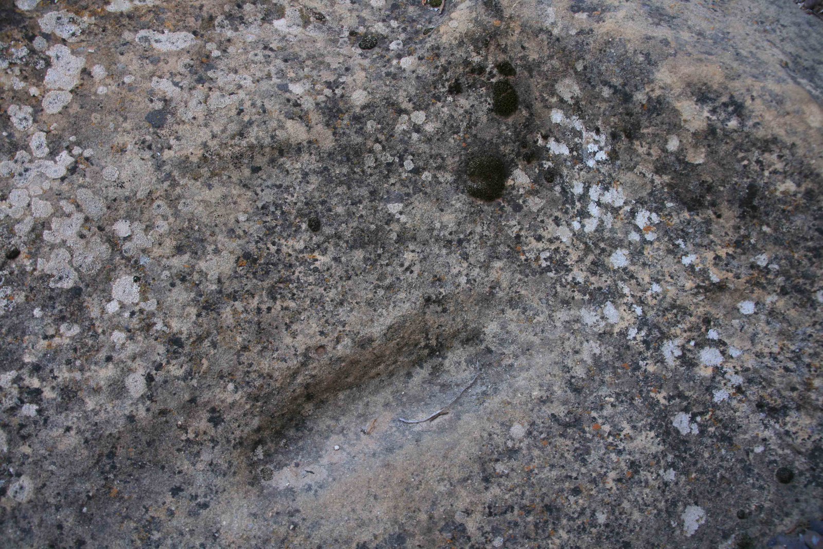 |
| Moqui Step at Hovenweep National Monument |
Great Thing #17: It reminds us how cultures are dynamic, flux & change, and WE weren't & aren't the only way it's ever been. It allows us to realize the choices we make actually are choices--culture is so arbitrary. That means we can make better choices about how we live.
--Anonymous Zion National Park Ranger
[Author's note: If our cultures change and we can make better choices, then we can also make better choices in order to change our culture: in how we interpret park resources and serve visitors. The National Park Service (NPS) is an agency with a very strong and significant institutional culture. I mentioned the cultural notion of "ranger playgrounds" earlier in this post. Similarly, I can not tell you how often I have heard rangers joking about the visitors, and the times I have willingly joined in. I have been making a conscious choice lately to step out of any conversation that makes fun of or is derogatory toward park visitors, and when appropriate, calling such behavior out. I find this disrespectful behavior quite offensive. It does not truly provide comic relief. This is part of our culture that simply must change. Similarly, giving visitors advice as if we were speaking in a mirror does not truly serve the visitor. We have visitors with a full range of interests, abilities, and previous experiences. We truly honor the visitors and the park resources we deeply care for when we take a moment to step outside ourselves, try to truly hear the visitors, and provide information and advice for THEM, not ourselves. Indeed, culture can change.]
Great Thing #18: This trail provides a good view of the new "temporary" parking lot which reminds me of two things: one, Edward Abbey's rage over development in National Parks and, two, Joni Mitchell's paving over paradise. This reminds me of the fundamental we, as park service staff, are here--to keep these beautiful places from being turned into fields of asphalt.
--Anonymous Zion National Park Ranger
[Author's note: Amen!]
Great Thing #19: You can wear your favorite outfit and hiking shoes on this trail.
--Anonymous Zion National Park Ranger
[Author's note: Well, I have to say that this one took me by surprise. It is my hope that the reference to a favorite outfit and hiking shoes implies that "you," meaning the "royal we," can head onto the Archeology Trail in uniform as part of our regular roving duties. By doing so, we are all presented with opportunities to interact with the place and our visitors in a positive way. I am a firm believer in being out where the visitors are. Knowing that a minority of park visitors participate in ranger-guided activities, I believe that the informal contacts on the trails are often the only opportunity a visitor might have to ask questions and interact with a ranger.
I must add, though, that this "Great Thing #19" could be a reference to one of the historic National Park Service uniforms. I recall sharing a story (emphasis on STORY) with some of my co-workers here at Zion about said uniform, a wannabe park ranger doing archival NPS photograph work in Charles Town, West Virginia, in the very same room where the historic uniforms are stored, an unlocked storage chamber, shall we say, "interpretive dance," and an unknown (to your author, at least) security camera. On this matter, I am confused about the truth. Nonetheless, someone in that outfit on the Archeology Trail would be very snappy!]
 |
| NPS Harpers Ferry Center Historic Photo #001064 |


